| Story LongWater created by Michael Newman |
In response to Michael Newman's 12 January
2010 letter to the Westwood
DPW
Tom and Mary Ann Soltys had Business Litigation Associates send this 19
January 2010 letter to Michael Newman claiming that there are misrepresentations about their
water flowing onto the road. This set of photos documents the water that flows from their property onto Sandy Valley Road.In the Soltys letter there is an allegation that the road is not sufficient for the Wildstar Farm Horse Barn that Michael Newman and his wife Polly Kornblith are planning to build. This allegation is one raised by the Mr. Soltys and others in an attempt to prevent the project. Mr. Soltys claims that the road is not sufficient for fire trucks and that therefor Wildstar Farm should be prohibited. From the Wildstar Farm perspective the road needs no changes to support the farm. Horses don't really care about potholes and ice dams. The letter shows where they are really coming from when they state: "In fact numerous residents prefer to keep the road in its present condition reflecting its "scenic way" designation and because it coincidentally helps control the speed and volume of traffic." Michael Newman spoke to Ralph Phaneuf of the Westwood DPW when he delivered the letter. Mr. Phaneuf stated that Sandy Valley Road is the worst road in town. He agreed that it should be resurfaced. Movie
showing water coming up from the reeds and out under the Soltys wall This movie shows a good overview The detail on the water flowing is limited (a big file, takes time to load). Movie
showing water coming out under the Soltys wall this movie shows more detail of the flow out from under the wall. Less of the context is shown (a big file, takes time to load). Movie
showing condition of Sandy Valley Road (again a big file).
|
 |
|
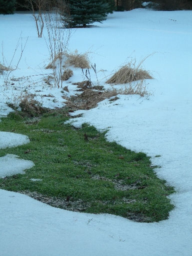
Photo #3 shows the flow of water on the Soltys property on 3/12/2009, prior to the work shown in Photo #4. At that time, the water ran over the Soltys driveway directly onto the road. The water appeared to come out of a pipe among the tall grass and ran continuously most of the year.
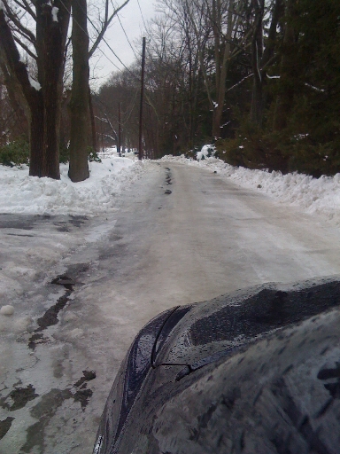
Taken in the 2008-2009 winter shows the icy condition of Sandy Valley road about 500 feet north of the Soltys driveway.
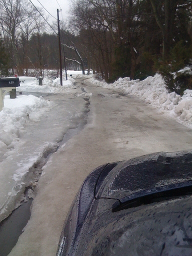
Photo #10 was taken a little further along SVR near number 439. The water channel in ice on the left is almost entirely water that originates on the Soltys property. Most of the water crosses the road at this point and flows into the wetlands on the right of the roadway.
Photo #4 shows the construction that was observed in 2009. The gravel area with the white stone goes under the wall at the left. Michael Newman saw work being performed on this area, including digging under the wall. This is where Michael Newman believes either a pipe was installed or a ditch was dug under the wall and filled with gravel.
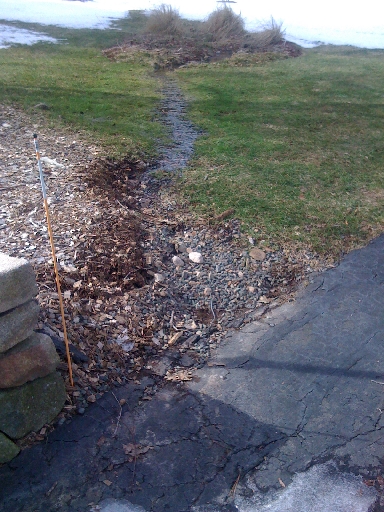
The water exits under the wall in the gravel at the center of this photo and enters the drainage ditch that runs under the driveway. From there it runs along the edge of the Soltys property and exits to the road near the fire hydrant where the ditch ends.
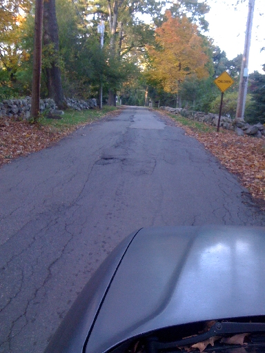
Photo #1 is taken at the beginning of Sandy Valley Road (SVR) near Gay street. The road's condition is adequate, if not good, at this point.
This photo is taken just south of the Soltys driveway. It still shows a less damaged roadway.
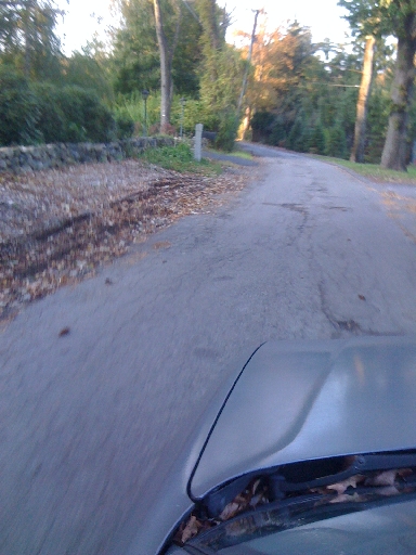
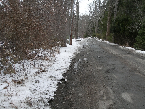
Photo #6 was taken just beyond the Soltys driveway. The source of the water at the top left is the discharge from the Soltys property. The roadway is more damaged from here on.
Photo #5 was taken in January 2010 and shows water emerging from the reeds and running over the lawn to the wall.
A closer shot of the reed area.
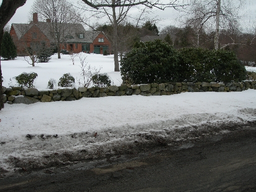
January 2010 view showing the Soltys house. It was taken south of the driveway before where the water is emitted.
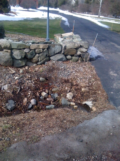
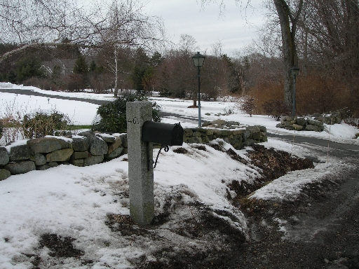
Overview of the Soltys Driveway. The wall with the water issues is just past the mailbox.
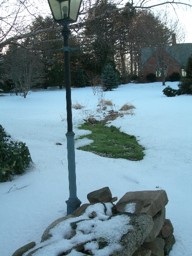
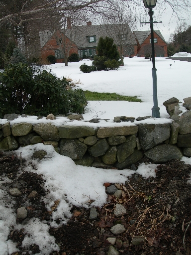
The reed area is behind the bush to the left of the lamp post. The gravel area where Michael Newman thinks there is a concealed pipe is directly under the lamp post. It is shown in detail in the next photo.
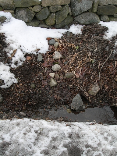
Photo #2 shows the gravel area where the water flows from the Soltys property into a drainage ditch. The water flows like a slowly running faucet out under the line of light-colored rocks in the middle of the photo.
Water flow is most apparent at the top left of this frame. It comes out and flows into the culvert at the right and from there to the other side of the driveway.
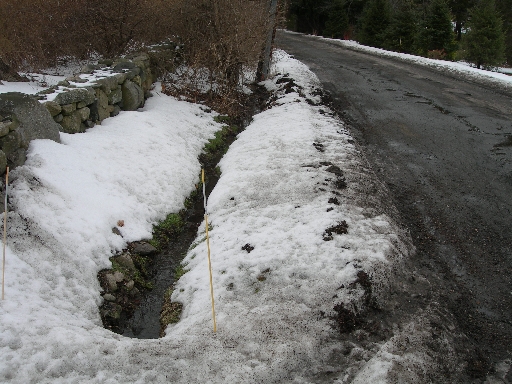
Photo #7 was also taken just beyond the Soltys driveway. The water flows through this drainage ditch all the way to the fire hydrant.
Photo #8 shows the continuation of the drainage ditch.
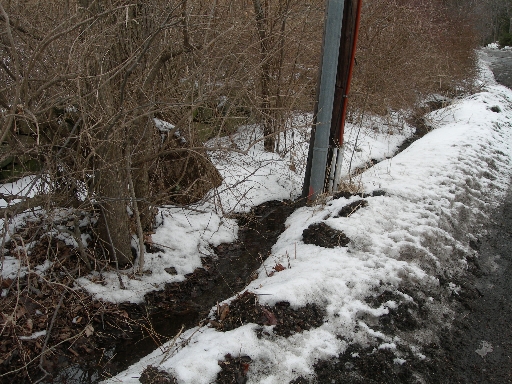
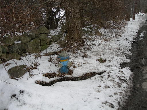
Photo #9 shows the final portion of the drainage ditch. The fire hydrant at the right of the photo, which is near the edge of the Soltys property, is where the water flows onto the road.
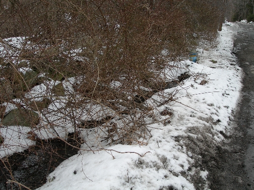
Water flows out to the road at the hydrant. Then it flows down the left side of the road for a distance.
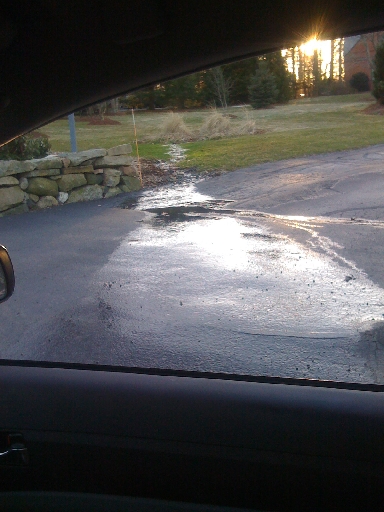
Near the telephone pole the water flows out onto the street leaving an icy mess. You can also see in this photo the damaged surface of the road. The road is clearly in worse condition where this water flow exists than in other areas.
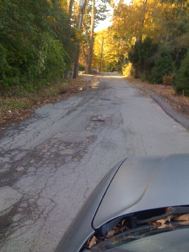
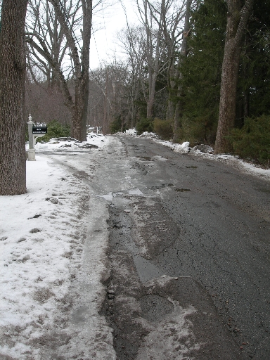
Photo #11 shows the road's condition in winter. The ice just past the telephone pole is the result of the water flowing off the Soltys property. The road's condition, particularly in the winter, makes it almost impassable, with potholes as big as 2 feet across and almost 1 foot deep. There is clearly the potential to damage a vehicle while driving down this portion of the road.
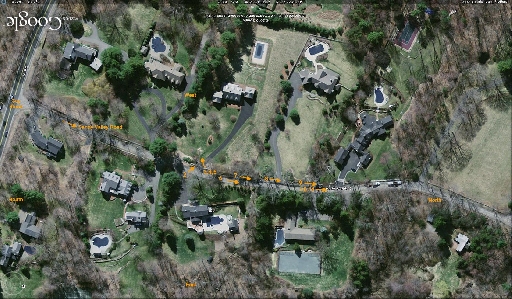
The location of where each photo was taken and the vantage point it was taken from photos are indicated with numbers and arrows on this map of Sandy Valley Road. Click the photo then click it again and stretch the window to expand the image.
Other photos taken at the same time that these photos were taken can be found in the directories that these photos came from. The photos in this story came from the following directories:
soltyswater
|